The Canadian National “Matteson Connection”
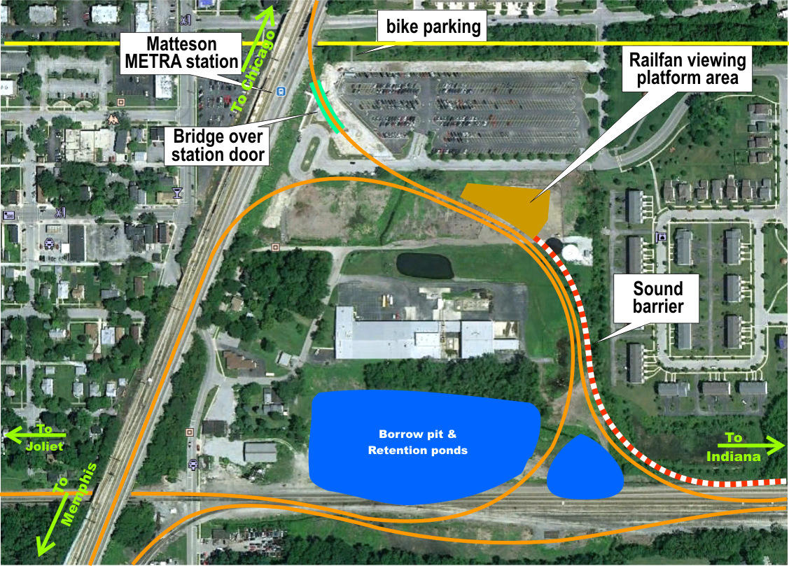
The Google earth view of the CN construction area (below) has an overlay showing the general layout of
the new double wye connector tracks and the location of the train viewing hill. The red-white line shows
the approximate position of the sound barrier wall while the blue area is the borrow pit and water
retention pond.
The east west tracks are the former EJ&E tracks while the slanting top to bottom tracks are the former
Illinois Central (IC) and Metra electric tracks.
Trains running from Joliet to Champaign loop over themselves. Trains longer than 3/4 of a mile and pass
over themselves.
The train viewing platform, 35 feet above ground level is planned on the northeast side of the loop.
More information can be found on
the Village of Park Forest website.
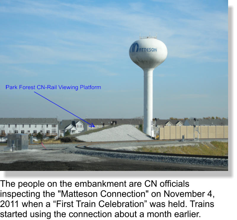
click any picture to enlarge

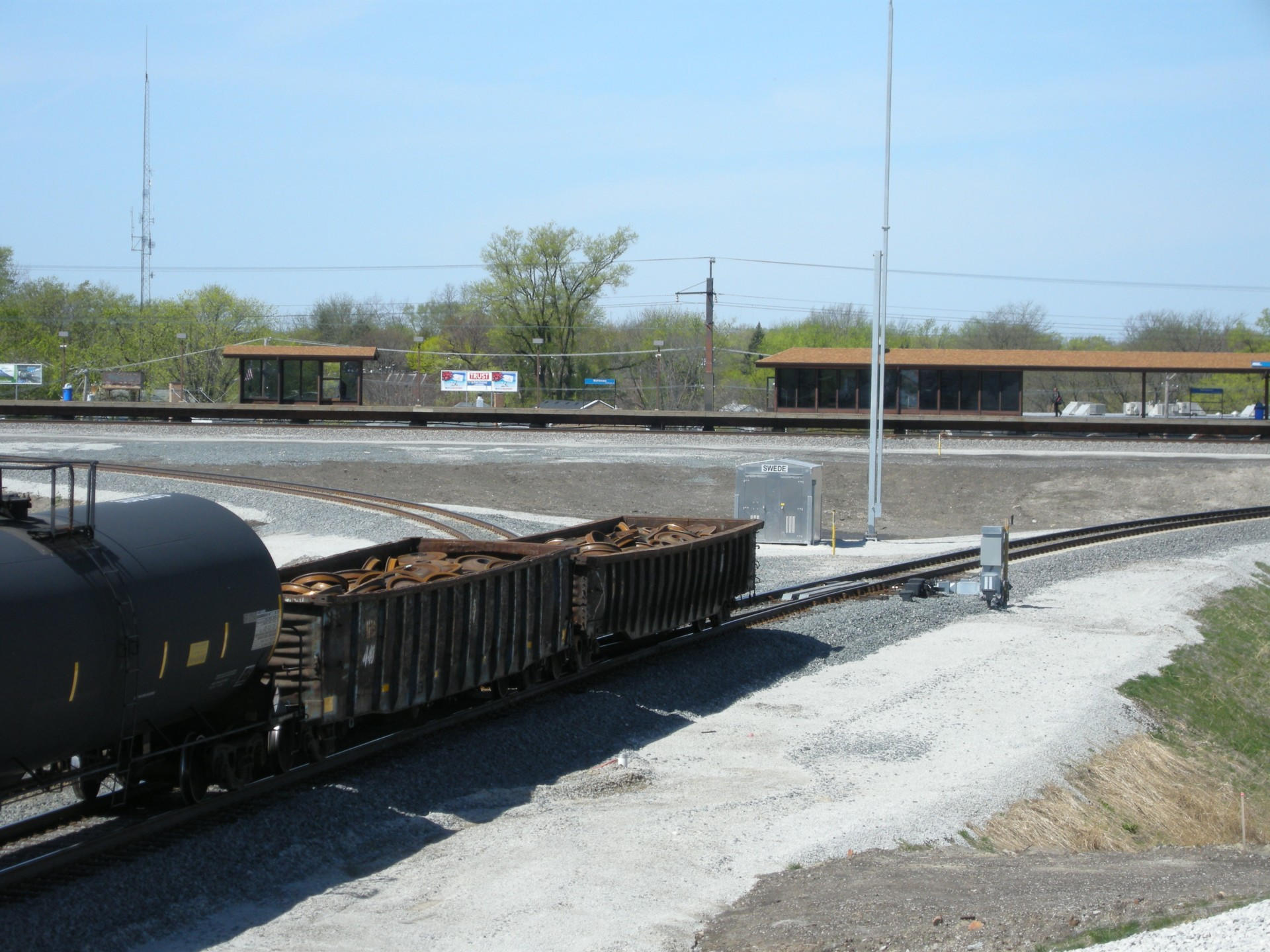
The upper wye looking west toward the Matteson METRA
station. Two gondolas loaded with wheels bring up the
rear of a mixed train of coil steel loaded gondolas and
tank cars. Photo taken from top of viewing hill.
Watch the Canadian National Railroad “Matteson Connection” video.


Old Plank Road Trail
A 22-mile recreation and nature trail in northeastern Illinois


